

PITC
Point In Time Count
2026 Point In Time Count:
How YOU can be involved
Volunteer
Hundreds of volunteers every year participate by joining our partner agencies in the field for a one (1) day survey of our houseless neighbors or by helping to pack incentive kits.
To become a volunteer, all applicants must meet the following criteria:
Must be 18+ years of age
Must attend one (1) mandatory volunteer training
Must have a working cellphone to access the survey
If you are interested in becoming a volunteer, please complete the form below:
Every year, we utilize monetary donations to purchase necessary items for our houseless neighbors, such as:
Socks
Underwear
Bandages
Water
Food (packaged)
Slippers
Condoms
Toothbrushes
Toothpaste
If you are interested in donating, please scan or click the QR code to donate.

January 26th, 2026
Monetary Donations
about the point in time count
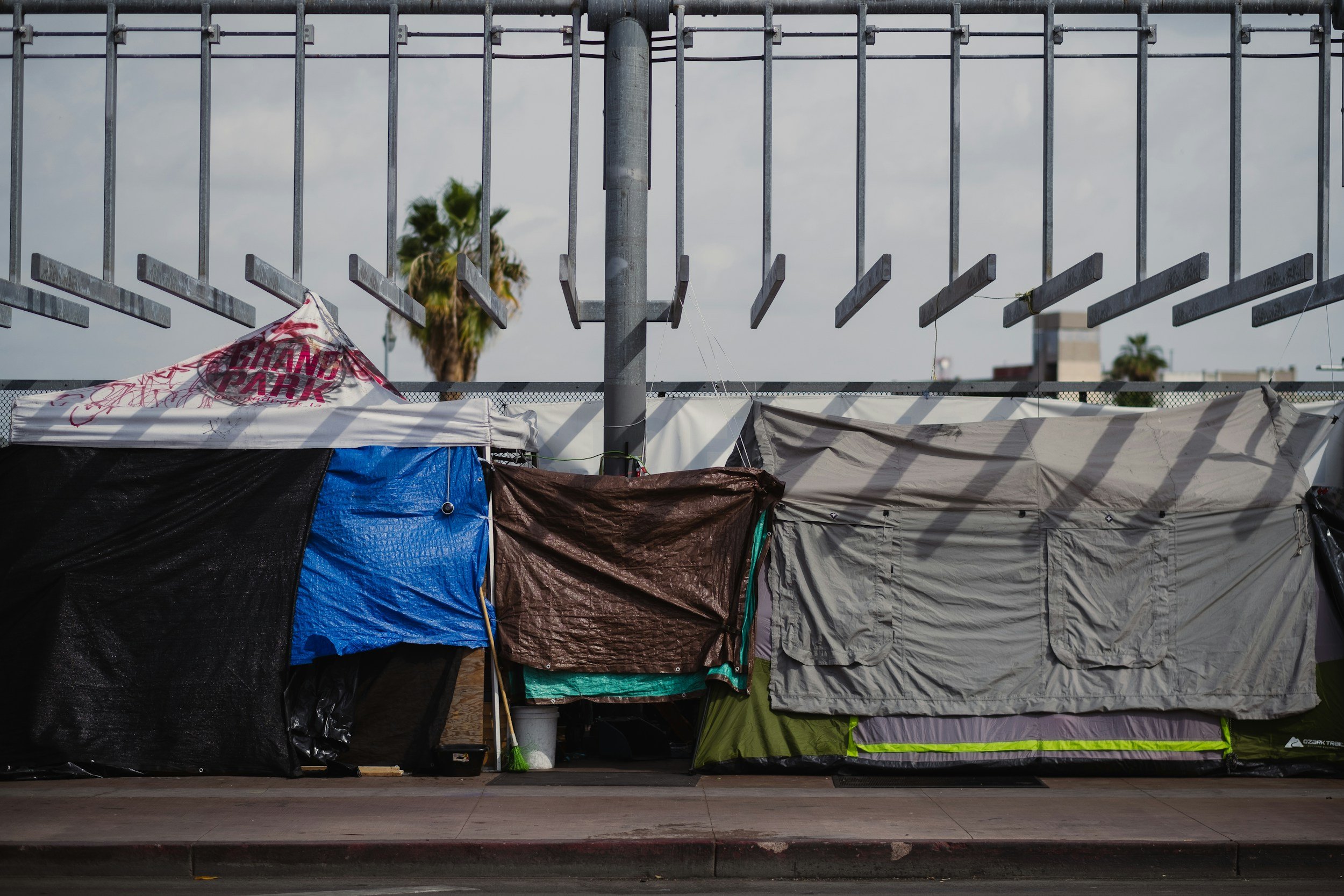
The Point in Time Count (PIT Count) is a federally mandated census count from the Department of Housing and Urban Development (HUD), to be completed biennially by each Continuum of Care across the United States. The PIT Count provides a snapshot of all those experiencing homelessness in our shelters, streets, beaches, cars, or other places not meant for human habitation. The PIT Count is vital for establishing federal funding from HUD as well as State, local and private funding to help end homelessness on O‘ahu. Although the PIT Count report represents a snapshot at one point in time, it provides us an opportunity to look at the trends and demographics of those experiencing homelessness in our community on a single night and across multiple years of Counts.
If you have any questions please contact the PIC planning team at at planning@partnersincareoahu.org
TRAINING RESOURCES & SURVEYS
All those participating as surveyors in the 2026 Point In Time Count must sign the Statement of Confidentiality.
If you are interested in donating items for participant incentive kits, please see the Amazon wishlist for specific items that will be useful.
Partners In Care provides resources to volunteers and those interested in knowing more about the Point In Time Count. These resources do not replace the need for training. Instead, they serve as a supplementary resource for volunteers and interested persons to prepare themselves for the PIT Count.


2024 pitc community report press release
2024 PITC Aggregated Street Map
This interactive map aggregates all 2024 PITC data to the nearest street centerline. Yellow streets indicate a higher count of individuals within the area while purple indicates a lower. Toggle layer visibility on or off in the left panel to review data for available categories.

POINT IN TIME COUNT Sub-REPORTS & Maps
-
-
-
-
-
2020 O‘ahu PIT Count 1 - Page Main Points
2020 Unsheltered PIT Heat Map
2020 Sub-Reports
Sexual & Gender Minorities Sub-Report
-
2019 O‘ahu PIT Count Report
-
-
FREQUENTLY ASKED QUESTIONS
-
The Point In Time (PIT) Count is an annual count that is required by HUD. This count is meant to provide a snapshot of how many individuals are currently experiencing homelessness within a given community.
-
Yes; the Point In Time Count is actually a Nationwide count.
However, the State of Hawai‘i has two distinct Continuum’s of Care (CoC): Partners in Care for O‘ahu and Bridging the Gap for the neighboring islands. Each CoC conducts a separate Point In Time Count for their designated area.
-
Unsheltered Homeless are individuals sleeping in places not meant for human habitation, including streets, parks, alleys, parts of the highway system, transportation depots, all night commercial establishments (e.g., movie theaters, laundromats, restaurants), abandoned buildings, building roofs or stairwells, caves, campgrounds, vehicles, and other similar places. Find more definitions here.
-
Unsheltered homeless are counted by doing a canvass of the island asking individuals a survey that covers demographic information among questions about their personal history.
Sheltered homeless are counted by pulling information from our county-wide Homeless Management Information System (HMIS) that stores enrollment and demographic data for homeless individuals staying at transitional or emergency shelters. Sheltered individuals are not given the same surveys as unsheltered individuals because most of the survey data can be pulled from enrollment data that has been entered in by service providers prior to the night of the count.
-
Hundreds of hours are spent collecting, inputting, and validating this data. However, Point In Time Count numbers are submitted or collected by hundreds of different community members, service providers, and individuals currently experiencing homelessness. The reliability of each count can be influenced by many factors, such as number of volunteers, understanding of training, and weather. Additionally, most of the data is self-reported directly from individuals experiencing homelessness. These numbers should be looked at to understand trends over time instead of taken as exact figures.
-
No. All data is shared only in aggregate form and is distributed equally to all community members. Partners In Care does not share specific personal or location information on individuals.
-
The PIT count is a federal requirement, and it is implemented with training and compassion. We count people experiencing homelessness so we can better understand the causes of their homelessness in order to develop better interventions and to connect them to service providers. We count individuals experiencing homelessness because we do not want them to become invisible.
-
No. According to the 2019 PIT Count report most individuals experiencing homelessness on O‘ahu are Native Hawaiian, other Pacific Islander, or multiracial. This finding suggests that homelessness on O‘ahu disproportionately affects Hawai‘i residents.
-
No. According to the 2019 PIT Count report only 24% of the total homeless individuals were experiencing serious mental health issues. This percentage is close to estimates of mental illness in the general population. Twenty percent of the total American population experiences mental health issues (NAMI, 2017).
-
Many major cities with similarly tight housing markets and rising income inequality are also experiencing this increasing trend. Until systemic change that directly reduces the poverty is achieved, homelessness is likely to continue to rise. However, O‘ahu data suggests that service providers and local government are housing the most vulnerable at higher rates than in previous years. For example, the amount of chronically homeless, mentally ill, and substance users being placed into emergency, transitional, and permanent housing has increased. We recommend a continuation of the current course in homeless intervention, along with a more aggressive approach to increasing the availability of affordable housing for everyday Hawai‘i citizens.